Carbon Market Network


Methane leaks are invisible, expensive and hard to prove. That is exactly why methane MRV platforms exist.
If you work in oil and gas, waste, agriculture or carbon markets, you will meet one question sooner or later: “How do we prove these methane numbers are real?”
A good platform answers it with data, not estimates. In this guide, you will learn how the best methane MRV platforms work, how they differ and how to pick the right one.
What Are Methane MRV Platforms?
Methane MRV platforms are systems that measure, report and verify methane emissions. They combine sensors, satellites, aircraft or drones with software that turns raw readings into audit-ready numbers.
The “MRV” part stands for three jobs:
- Monitoring: Detecting and measuring methane at a site, asset or region.
- Reporting: Packaging that data into formats that regulators, buyers and investors accept.
- Verification: Letting an independent party check that the numbers hold up.
MRV vs dMRV in Plain Words
Traditional MRV leans on manual inspections, spreadsheets and annual estimates. It is slow, patchy and easy to challenge.
dMRV (digital MRV) automates most of that work. Sensors and satellites collect data continuously. Software cleans it, calculates emissions and keeps an audit trail.
For methane, dMRV matters even more. Leaks start and stop without warning, and a once-a-year check can miss most of them.
Why Methane Needs Its Own Approach
Methane is a powerful greenhouse gas that traps far more heat than carbon dioxide over a short period. It is responsible for roughly a third of today’s warming.
It also leaves the atmosphere faster than CO2. So cutting methane gives a quick climate payoff.
That combination explains the push for better methane emissions monitoring everywhere.
Carbon Market Insider Newsletter
Weekly insights on carbon markets, climate policy, carbon credits, and sustainability.
Why Demand for Methane MRV Platforms Keeps Growing
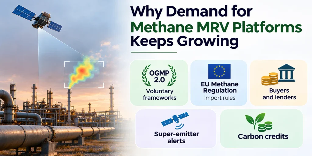
Several forces push companies toward digital methane monitoring at once.
- Voluntary frameworks: The Oil and Gas Methane Partnership (OGMP 2.0), run under UNEP, asks members to report measured, source-level and site-level emissions. It has more than 150 member companies.
- Import rules: The EU Methane Regulation asks importers of oil, gas and coal to show that suppliers use MRV equivalent to EU rules. OGMP 2.0 Level 5 with independent verification is one accepted route.
- Buyers and lenders: LNG buyers, utilities and banks increasingly ask for proof of low methane intensity.
- Super-emitter alerts: Satellite programs now flag large leaks and notify governments and operators.
- Carbon credits: Methane projects in landfills, farms and energy need strong dMRV to earn trust.
A Quick Note on Shifting Rules
Regulations keep moving. The European Commission has proposed delaying some importer obligations under its methane rules.
In the United States, federal methane rules have seen deadline extensions and a delayed methane fee, while state programs and buyer demand continue.
Always check the latest legal position before you plan a compliance budget. The direction of travel still points toward more measurement, not less.
How Methane MRV Platforms Work: Step by Step
Most platforms follow the same basic workflow.
- Detect: Sensors, cameras, drones, aircraft or satellites spot methane.
- Quantify: Software estimates the emission rate, often in kilograms per hour.
- Locate: The system links the plume to a site, equipment group or facility.
- Reconcile: Measured data is compared against the company’s bottom-up inventory.
- Report: The platform builds reports for OGMP 2.0, regulators, certifiers or buyers.
- Verify: A third party reviews methods, data and uncertainty.
- Act: Crews fix the leak, and the platform logs the repair.
That last step matters. A platform that only counts leaks, without helping teams fix them, delivers half the value.
Types of Methane Monitoring Technology
No single sensor does everything. Most strong programs mix several layers.
| Technology | Best at | Main limitation |
|---|---|---|
| Satellites | Wide coverage, remote assets, large leaks | Cannot see small leaks; cloud and revisit gaps |
| Aircraft (lidar or spectrometer) | Facility-level surveys with precise location | Snapshot in time, weather dependent |
| Drones | Close inspection of specific equipment | Short range, flight rules |
| Fixed continuous sensors | Catching leaks the moment they start | Hardware cost and site installation |
| Camera-based monitoring | Visual plume tracking over a site | Line of sight and power needs |
| Handheld tools | Targeted LDAR inspections | Labor heavy, periodic |
Smart operators layer them. Satellites screen widely, aircraft or drones confirm, and fixed sensors watch the highest-risk sites all day.
How We Chose These Methane MRV Platforms
This list is not a paid ranking. I focused on platforms with a clear methane focus and real use in the field.
I looked at five things:
- Data quality: Detection, quantification and independent testing.
- Reporting strength: Support for OGMP 2.0, regulations and certification.
- Coverage: Global reach, asset types and sensor flexibility.
- Track record: Regulatory approvals, major customers and recent progress.
- Transparency: How openly the company shares methods and results.
The order below groups platforms by role rather than declaring one winner. The best choice depends on your assets, your regulator and your budget.
Top 10 dMRV Platforms for Methane Monitoring
1. GHGSat
Best for: Satellite-based, facility-level methane monitoring worldwide.
GHGSat runs a large commercial fleet of satellites built for greenhouse gas monitoring. It can trace methane to individual facilities, from oil and gas sites to landfills.
Its first-generation satellites detect leaks from about 100 kilograms of methane per hour. A next-generation satellite aims to reach around 50 kilograms per hour.
The company keeps adding satellites, and it has drawn recent investment from Mitsubishi Electric and MUFG Bank. Customers have included ExxonMobil, Aramco, the UK Space Agency and UN organizations.
Why it stands out: Frequent, high-resolution revisits of specific sites.
Keep in mind: Satellites miss small, short leaks. Pair them with ground or aerial data for full coverage.
2. Kayrros
Best for: Global screening, super-emitter detection and independent verification.
Kayrros is a geoanalytics company. Its Methane Watch platform uses AI on multiple satellite datasets to find and quantify large methane events across the planet.
UNEP’s International Methane Emissions Observatory (IMEO) uses Kayrros data to support its Methane Alert and Response System. Kayrros also spotted a huge, months-long leak in Kazakhstan that drew global attention.
It has also released a free AI chat tool that lets anyone ask plain-language questions about methane emitters.
Why it stands out: Wide, independent view that works without installing anything on site.
Keep in mind: Satellite-only views work best for large emitters. Operators still need site-level data for inventories.
3. Project Canary
Best for: Continuous monitoring and emissions data for oil and gas operators.
Project Canary began as a continuous monitoring company in Denver. Its Canary X system tracks methane at well pads and facilities all day.
The US EPA approved Canary X as an alternative test method for fugitive emissions screening. The company also offers an emissions accounting product called Canary Carbon Portal, plus mobile and handheld tools.
Project Canary once blended measurement with certification. It later shifted focus toward measurement and data, after criticism from environmental groups about that combined model.
Why it stands out: Full stack from hardware to software, with regulatory recognition.
Keep in mind: Ask how data integrates with your chosen certifier or auditor.
4. Highwood Emissions Management (Emissions Intelligence Platform)
Best for: Measurement-informed methane inventories and OGMP 2.0 reporting.
Highwood is a Calgary company that builds software and advisory services around methane inventories. Its Emissions Intelligence Platform (EIP) reconciles measurements with company inventories.
It supports OGMP 2.0, EU import requirements, MiQ, Veritas and similar frameworks. Highwood says its clients account for over 10 percent of global oil and gas output, and it helped Triple Crown Resources reach OGMP 2.0 Level 5 Gold Standard.
It also announced a partnership with Bridger Photonics to pair aerial data with reporting workflows.
Why it stands out: Strong on reconciliation, the hardest step to Level 5.
Keep in mind: It focuses on data and inventories, so you still need measurement sources.
5. SensorUp
Best for: Low-code methane data management and certification workflows.
SensorUp is a Calgary software company that helps energy firms collect, organize and report emissions data. Its low-code approach lets teams connect many sensor and data sources.
It signed an agreement with MiQ, the methane certification body, to embed methane data directly into its platform. The goal is to automate methane intensity calculations from different sensors.
Why it stands out: Flexible integration across many data sources.
Keep in mind: Like Highwood, it works best when paired with strong measurement partners.
6. Qube Technologies
Best for: Continuous methane monitoring across oil and gas, biogas and landfill sites.
Qube, also from Calgary, sells a family of continuous monitors. Qube Fenceline covers whole sites, Qube Lite watches individual sources, and Qube Handheld supports inspections.
It holds EPA approval as an alternative test method for continuous point-source monitoring. New Mexico also conditionally approved it as an alternative monitoring technology for oil and gas facilities, and Alberta regulators approved it for operator use.
Its platform has also met SOC 2 Type II security standards, which matters for data-sensitive buyers. Qube cites independent controlled-release studies at landfills as evidence of strong accuracy.
Why it stands out: Strong regulatory approvals across several jurisdictions.
Keep in mind: Study results come partly from the company. Ask for the full test reports.
7. LongPath Technologies
Best for: Laser-based monitoring across large, spread-out infrastructure.
LongPath builds continuous emissions networks that use lasers to cover wide areas. Its focus is real-time data across the oil and gas supply chain, with expansion into other sectors.
Area-wide laser networks suit basins and pipeline corridors, where putting a sensor on every asset would cost too much.
Why it stands out: Efficient coverage of large areas with fewer devices.
Keep in mind: Ask how the system attributes emissions to specific sources within a dense site.
8. Bridger Photonics
Best for: Aerial lidar surveys that locate and quantify leaks precisely.
Bridger, based in Montana, flies aircraft with its Gas Mapping LiDAR. The EPA approved this method as an alternative test method for fugitive methane monitoring.
Operators use it across wells, pipelines, compressor stations and LNG facilities. Bridger says its data has helped customers such as Cheniere, ConocoPhillips, Devon, EQT, Woodside and ExxonMobil reach OGMP 2.0 Gold Standard.
Why it stands out: High-quality source location from the air, with strong regulatory standing.
Keep in mind: Aerial surveys capture a moment in time. Add continuous monitoring for intermittent leaks.
9. Sensirion Connected Solutions (Nubo Sphere, Kuva and SeekOps)
Best for: Mixed sensor portfolios, including fixed sensors, cameras and drones.
Sensirion Connected Solutions offers its Nubo Sphere continuous monitoring system. It also acquired Kuva Systems, a camera-based continuous monitoring company whose camera has received EPA approval.
Sensirion’s methane portfolio also connects to drone-based sensing from SeekOps, whose SeekIR sensor supports OGMP 2.0 and MiQ-style reporting.
Why it stands out: One group covering several detection styles.
Keep in mind: Confirm which product, data platform and support team you would actually work with.
10. Carbon Mapper
Best for: Free, public satellite data on methane super-emitters.
Carbon Mapper is a nonprofit coalition that includes Planet Labs, NASA’s Jet Propulsion Laboratory, RMI, the California Air Resources Board and Arizona State University. Its Tanager satellites detect methane and CO2 plumes at facility level.
The data portal is public for noncommercial use. It has published thousands of methane plumes, and its data feeds UNEP’s Methane Alert and Response System.
California’s satellite methane program uses Carbon Mapper data, and officials credit it with helping stop dozens of large leaks.
Why it stands out: Open data that anyone, including journalists and regulators, can check.
Keep in mind: It focuses on large emission events, and public data may arrive with a delay. It is not an inventory tool for operators.
Quick Comparison of the Top Methane MRV Platforms
| Platform | Main method | Best for | Reporting support |
|---|---|---|---|
| GHGSat | Satellites | Facility-level global monitoring | Data and alerts for reporting |
| Kayrros | Satellite analytics, AI | Global screening, super emitters | Independent verification data |
| Project Canary | Continuous sensors | Well pads and facilities | Emissions accounting portal |
| Highwood EIP | Software and analytics | Inventories, OGMP 2.0 Level 5 | OGMP, EU, MiQ, Veritas |
| SensorUp | Software, low-code | Data integration | MiQ-linked workflows |
| Qube | Continuous sensors | Oil and gas, biogas, landfills | Regulatory alternative monitoring |
| LongPath | Laser networks | Large area coverage | Real-time emissions data |
| Bridger Photonics | Aerial lidar | Leak location and quantification | OGMP-aligned data |
| Sensirion group | Sensors, cameras, drones | Mixed portfolios | OGMP and MiQ support |
| Carbon Mapper | Satellites, public data | Open super-emitter data | Public alerts |
Free and Public Methane MRV Platforms Worth Knowing
You do not always need a paid tool to start learning.
- Eye on Methane (UNEP IMEO): A public platform that gathers methane data from satellites, companies and research. It also offers a secure portal for governments and OGMP 2.0 companies.
- Methane Alert and Response System (MARS): The first global system that gives free satellite-based alerts on major emission events to governments and companies.
- Carbon Mapper data portal: Public plume data for noncommercial use.
- Kayrros Methane Watch map: A free map view of emitters, including an AI chat interface.
Use these for research, screening and checking claims. They do not replace an operator’s own inventory system.
Methane dMRV Beyond Oil and Gas
Oil and gas gets most of the attention, but methane comes from many sources.
| Sector | Main source | Typical monitoring approach |
|---|---|---|
| Landfills | Decomposing waste | Satellites, fixed sensors, drones |
| Rice farming | Flooded fields | Satellite data, field data, crop models |
| Biogas | Digesters and handling | Continuous monitors |
| Coal mines | Ventilation and drainage | Sensors and flow measurement |
Real-World Example: Rice and Methane Credits
Mitti Labs works with rice farmers on a practice called alternate wetting and drying. Farmers drain and re-flood fields in cycles instead of keeping them flooded all season.
This cuts methane without hurting yields. Mitti Labs uses a dMRV system that mixes satellite remote sensing, field data and crop modeling to quantify the reductions behind its carbon credits.
This shows how methane dMRV also supports carbon markets. If you want a wider view of dMRV across all project types, read our guide to top carbon MRV companies in the world.
How to Choose the Right Methane MRV Platform
Follow these steps before you sign anything.
- Define your goal. Are you chasing OGMP 2.0 Level 5, EU import compliance, regulatory approval or credit generation?
- Map your assets. Remote wells, dense facilities and landfills need different tools.
- Pick your detection layers. Decide how you will combine satellites, aircraft, drones and fixed sensors.
- Check regulatory approvals. Confirm the system is accepted where you operate.
- Test data quality. Ask for independent controlled-release results.
- Review reporting outputs. Make sure the platform exports in the formats your auditors and buyers expect.
- Plan the response. Choose tools that feed leak repair workflows, not just dashboards.
- Run a pilot. Start with a few sites before a full rollout.
Questions to Ask Every Vendor
- How was your detection and quantification accuracy tested, and by whom?
- What is your minimum detection threshold under real field conditions?
- How do you handle uncertainty and intermittent emissions?
- Can I export raw data and keep ownership of it?
- Which regulators, certifiers and frameworks accept your outputs?
- How do you protect data security and audit trails?
Common Mistakes to Avoid
| Mistake | Why it hurts | Better move |
|---|---|---|
| Buying only one sensor type | Leaves coverage gaps | Layer technologies |
| Chasing the lowest price | Weak data fails audits | Pay for tested accuracy |
| Ignoring reconciliation | Blocks Level 5 progress | Choose software that reconciles |
| Treating it as a reporting task | Leaks keep running | Link detection to repair |
| Skipping a pilot | Surprises at scale | Test first |
Trends Shaping Methane MRV Platforms
The market keeps changing. A few trends stand out.
- More satellites, faster revisits. New fleets will shrink detection gaps and lower thresholds.
- Open data pressure. Public datasets make it harder to hide large leaks.
- Platform partnerships. Sensor makers and software firms increasingly team up for end-to-end offers.
- AI everywhere. Machine learning cleans data, attributes sources and flags anomalies.
- Verification demand. Third-party checks are becoming standard, not optional.
- Broader scope. Methane dMRV is spreading into waste, agriculture and carbon credit projects.
What Methane Monitoring Looks Like in Practice
Here are three simple scenarios.
- A satellite alert triggers a fix. A satellite flags a large plume at a remote site. The operator receives a notification, sends a crew and logs the repair.
- A fixed sensor catches a short leak. A continuous monitor spots a sudden spike at night. The system alerts the team before the leak runs for weeks.
- A reconciliation closes a gap. An operator compares its estimated inventory with aerial survey data. The gap reveals under-reported sources, so the team updates its numbers and moves closer to Level 5.
Each case shows the same idea. Good methane MRV platforms turn detection into action and action into proof.
Conclusion
The best methane MRV platforms do three things well. They detect leaks reliably, report numbers credibly and help teams act fast.
No single tool wins everywhere. GHGSat, Kayrros and Carbon Mapper shine from space. Bridger, Qube, LongPath and the Sensirion group cover the ground and air. Highwood, SensorUp and Project Canary connect the data to reports.
Start with your goal, layer your detection methods and test before you scale. Pick methane MRV platforms that give you data you can defend in front of regulators, buyers and auditors.
Methane dMRV is moving fast, so revisit your setup often.
Frequently Asked Questions
What are methane MRV platforms?
Methane MRV platforms are systems that measure, report and verify methane emissions. They use sensors, satellites, aircraft or drones, plus software that produces audit-ready data.
What is the difference between MRV and dMRV for methane?
MRV is the general process of measuring, reporting and verifying emissions. dMRV does the same thing with digital tools, so data collection, calculation and record-keeping happen automatically and continuously.
Which methane MRV platform is best for oil and gas operators?
It depends on your assets and goals. Operators often combine satellite screening, aerial or drone surveys and continuous sensors, then use inventory software to reconcile the data for OGMP 2.0 reporting.
What is OGMP 2.0 and why does it matter?
OGMP 2.0 is a UNEP-led reporting framework for methane from oil and gas. It has five reporting levels, and the top level combines source-level and site-level measurements. Buyers, lenders and regulators increasingly treat it as a benchmark.
Can satellites detect all methane leaks?
No. Satellites detect larger leaks well, but small or short-lived leaks can slip through. Aircraft, drones and ground sensors fill those gaps.
Are there free methane monitoring platforms?
Yes. UNEP’s Eye on Methane and its Methane Alert and Response System, the Carbon Mapper data portal and Kayrros’ public map all offer free access to methane data.
How does the EU Methane Regulation affect methane MRV platforms?
It requires importers to show that suppliers use MRV equivalent to EU rules, and OGMP 2.0 Level 5 with independent verification is one route. The Commission has proposed delaying some importer deadlines, so check the latest timeline.
Do methane MRV platforms work for landfills and farms?
Yes. Satellites and fixed sensors monitor landfill methane, while rice projects use satellite data, field records and crop models to measure reductions.
How much do methane MRV platforms cost?
Pricing varies widely by technology, number of sites and service level. Free public data costs nothing, while continuous sensors and aerial programs need larger budgets. Request quotes and run a pilot first.